A remarkable historical map of Howth Castle Demesne is among the centrepieces of Pivot Points, the landmark exhibition marking the 50th anniversary of the Irish Architectural Archive (IAA), currently on view at 45 Merrion Square, Dublin.
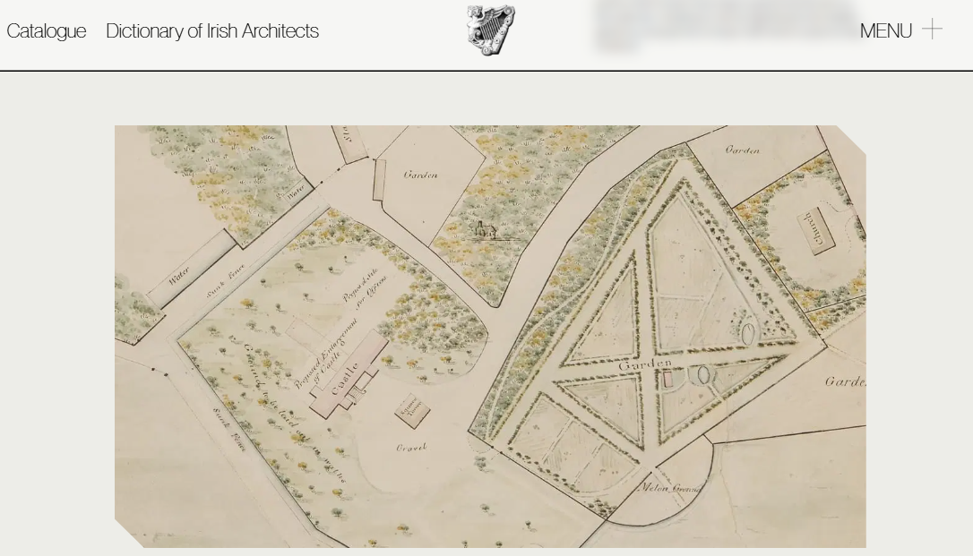
The work in question, Plan of Intended Alterations Proposed to be made at Howth Demesne, dating from 1740, is a large ink and colour wash drawing produced by John Hill, a 'Surveyor of Lands & Valuer of Estates', recording proposed alterations to the estate conceived by Thomas Simpson. It offers a vivid window into an estate in transition: the north and east wings of the castle are absent from the drawing, while a 'Proposed Enlargement' marks the site of what would eventually become the west wing, placing the map at a precise and fascinating moment in the castle's architectural evolution, just before additions carried out for William St Lawrence, 14th Baron Howth.
The map formed part of the St. Lawrence family collection and was donated to the IAA in 2024. When it arrived, the drawing was in a fragile state, torn, creased, and with significant losses, but has since been carefully restored by paper conservator Liz D'Arcy, thanks to funds bequeathed to the IAA by the late Homan Potterton.
Beyond its condition, the drawing is a genuinely significant document of Irish landscape history. It captures the moment when Irish landholders were moving away from fortified, enclosed demesnes toward more open, designed landscapes, removing enclosure walls, laying out formal gardens, developing walks and water features, and planting trees to frame views to and from enlarged country houses. All of these shifts are legible in Hill's drawing of Howth. Many of the features shown were still identifiable on Ordnance Survey maps well into the twentieth century, and some can even be traced on the ground today despite the later transformation of much of the demesne for golf use.
The exhibition situates the map within the theme of Rural Planning: Country Houses and Landscape, with an accompanying essay by Professor Finola O'Kane of University College Dublin, who explores how the drawing relates to a landscape painting of the demesne attributed to Dutch painter William van der Hagen, and what both reveal about how the St Lawrence family shaped — and were shaped by the land around them.
Pivot Points is open Monday to Friday, 10am–5pm, at the Irish Architectural Archive, 45 Merrion Square, Dublin 2. The entry for this piece can be viewed at irisharchitecturalarchive.ie.
Posted on 29 Jun 2026.